
ABSECON INLET BIOLOGICAL STUDY
Absecon Inlet
Did you know…
Absecon Inlet leads from barrier islands within Absecon Bay and Reeds Bay in Atlantic County, New Jersey out to the Atlantic Ocean.
Its southern shore is the north end of Absecon Island, on which lies Atlantic City, NJ, the largest city along the Jersey Shore. Absecon Lighthouse is on the south end of the inlet. Brigantine Island is to the north. The Brigantine Bridge carries New Jersey Route 87 over the inlet.
Absecon Inlet is navigable for small-sized vessels and provides ingress and egress to the waters of Absecon and Reed's Bays, small bodies of water in Atlantic County.
The word Absecon is from the native Lenape people’s word for little water or "Absegami.” This word was supposedly used by prehistoric Lenape people who lived along the small waterway of present-day Absecon Creek.

According to the National Audubon Society:
The estimated 260 acres of remnant beach and dune habitat located along the northern edge of the inlet are, consequently, extremely important to breeding and migrating birds. Beyond the open waters of Absecon Inlet lie the vast tidal salt marshes and creeks of Absecon Wildlife Management Area and the Brigantine Division of the Edwin B. Forsythe National Wildlife Refuge. The site intersects the Brigantine Island Natural Heritage Priority Site, designated by New Jersey Department of Environmental Protection as some of the state’s most significant natural areas.
Conservation Issues
Although the beaches are clean and wide, the swift tidal waters flowing through the inlet naturally cause severe erosion. Efforts to control erosion in this area have been unsuccessful. In addition to direct loss of habitat, declines in beach-nesting birds can also be attributed to human disturbance, including vehicles on the beach, and predation by small mammals and gulls. Fencing and nest exclosures help to protect birds during the breeding season. Recreational use of the area should be prohibited at critical times of the year as well.
The History of Absecon Inlet
According to the Atlantic City Free Public Library:
The ocean waters off Absecon Inlet were considered some of the most deadly along the East Coast. Between 1847 and 1856, at least sixty-four ocean-going ships were lost off the coast of Absecon Beach. Dr. Jonathan Pitney, who promoted the development of Atlantic City, lobbied the federal government for a lighthouse as early as the 1830's. In the first ten months after Absecon Lighthouse was lit in 1857, not a single ship was wrecked. When built, the Lighthouse stood about 1200 feet from the ocean. The relentless pounding of the waves quickly eroded the coastline surrounding the beacon, bringing water onto the corner of the Lighthouse property by 1876. The construction of jetties reversed this process, and subsequent homes and hotels separated the Lighthouse from the sea, resulting in the landscape you see today.

Absecon Inlet, Atlantic City, New Jersey. Date 1926-1927. From the Library Company of Philadelphia.
Absecon Inlet separates Absecon Island from Brigantine Island, and including its continuation, Absecon Channel, connects Absecon Bay and Reeds Bay with the Atlantic Ocean.
Absecon Inlet was described in 1878, viz.,
Absecon Inlet is navigable for small-sized coasting vessels, and furnishes ingress and exit to the waters of Absecon and Reed's Bays, small bodies of water in Atlantic County. No considerable stream except Absecon Creek flows into them.
Source: Historical and Biographical Atlas of the New Jersey Coast, Woolman and Rose, Philadelphia, 1878; p. 20

Biological Surveys of the Absecon Inlet:
MORE INFORMATION
Many fiddles Crabs (1000+) were discovered living in the wetlands along the inlet on the Brigantine City side. There is much evidence to suggest that certain wetland species may serve as bioindicators, including fiddler crabs, Uca.

A Marbled Godwit was seen on the Brigantine City side of the inlet, Saturday morning, April 15, 2023
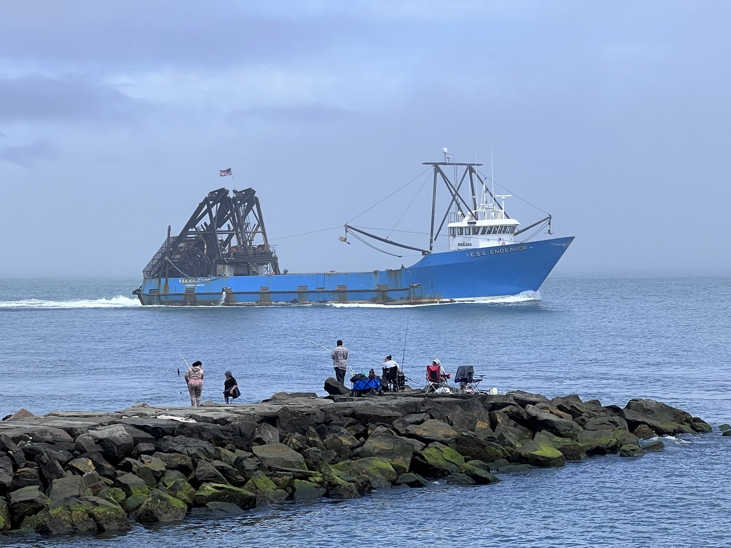
Large commercial fishing vessel leaving the Absecon Inlet for the Atlantic Ocean on a foggy Saturday, April 15, 2023. Atlantic City’s fishery provides much of the world's supply of minced clams and clam strips by harvesting ocean quahogs and surf clams.
The opening of the Absecon Inlet during the late 19th century. Published in 1881. From the Library of Congress, Geography and Map Division.
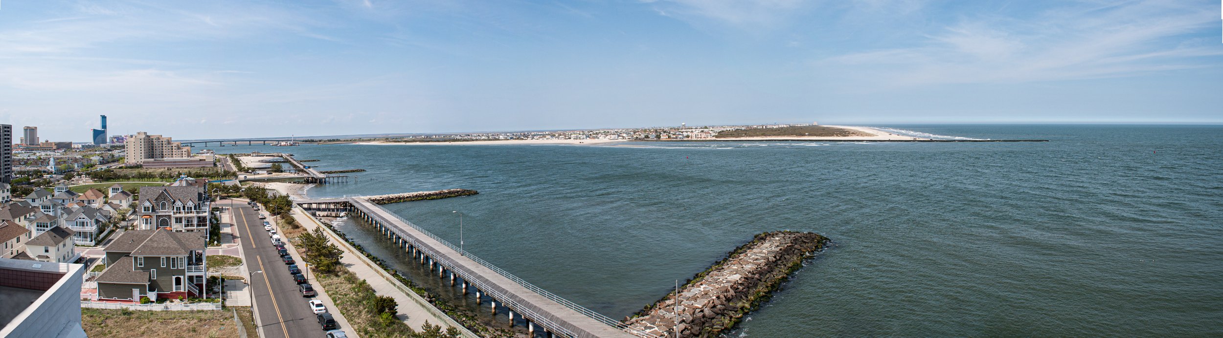
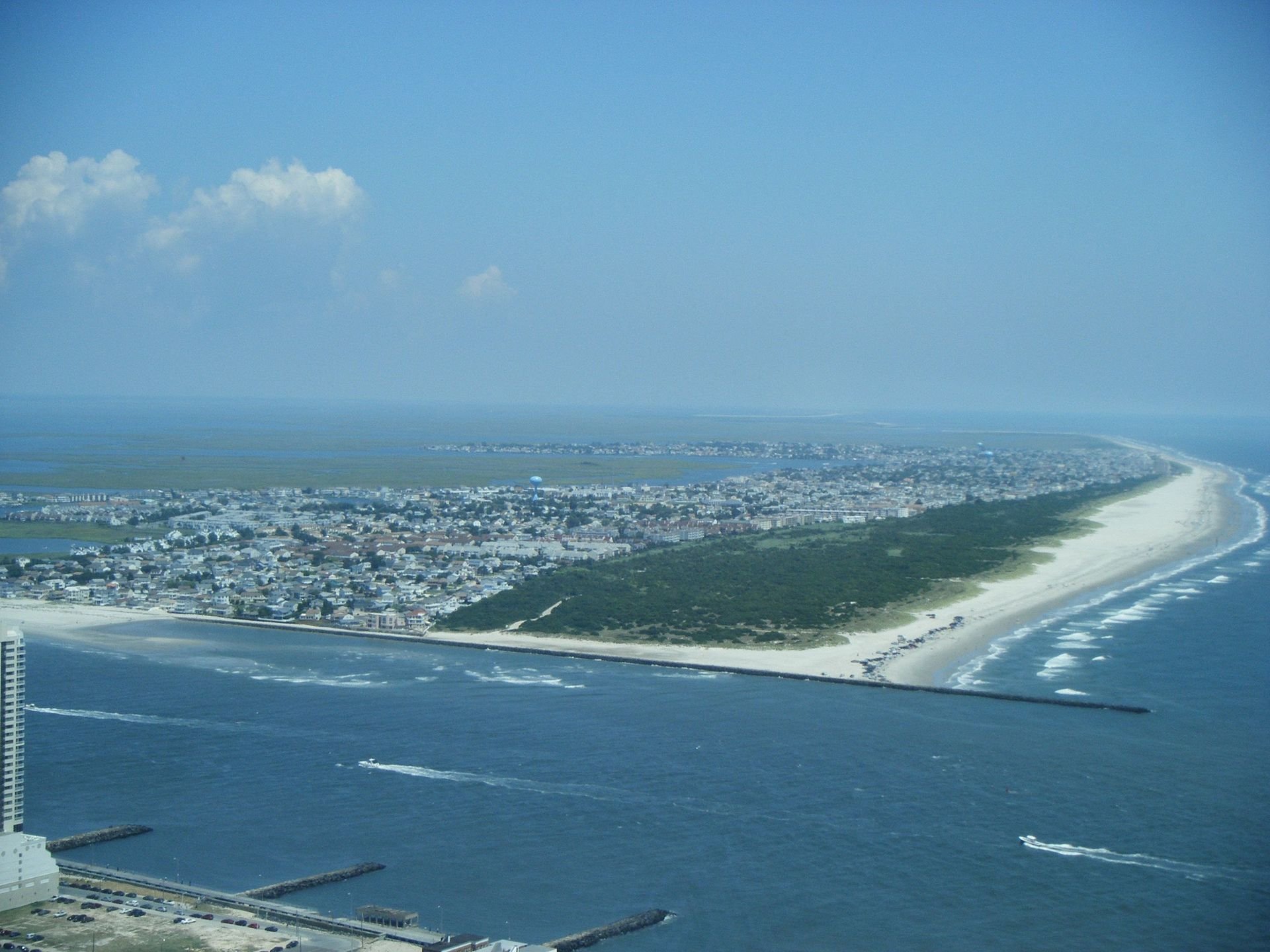
The current profile of the Absecon Inlet.

1894 Topo Map of Absecon Inlet and surrounding area.

1896 ATLANTIC CITY NEW JERSEY BUCKS & GARDINER'S BASIN ABSECON INLET ATLAS MAP